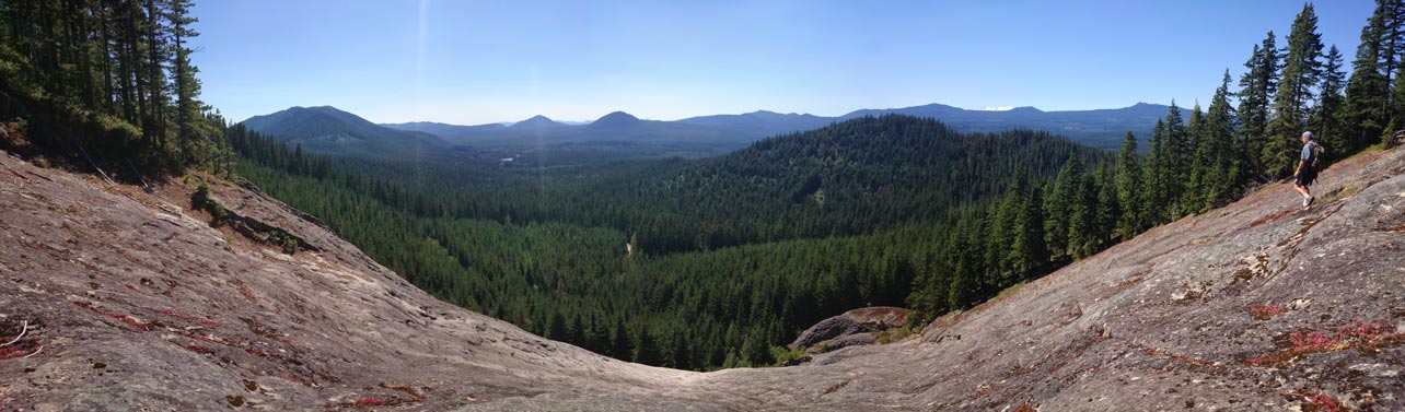
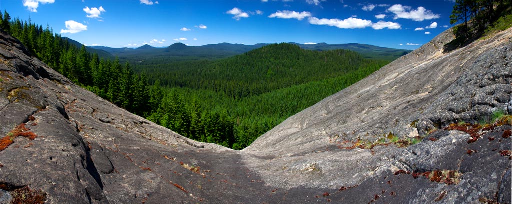
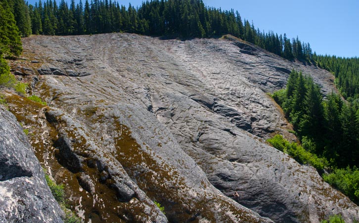
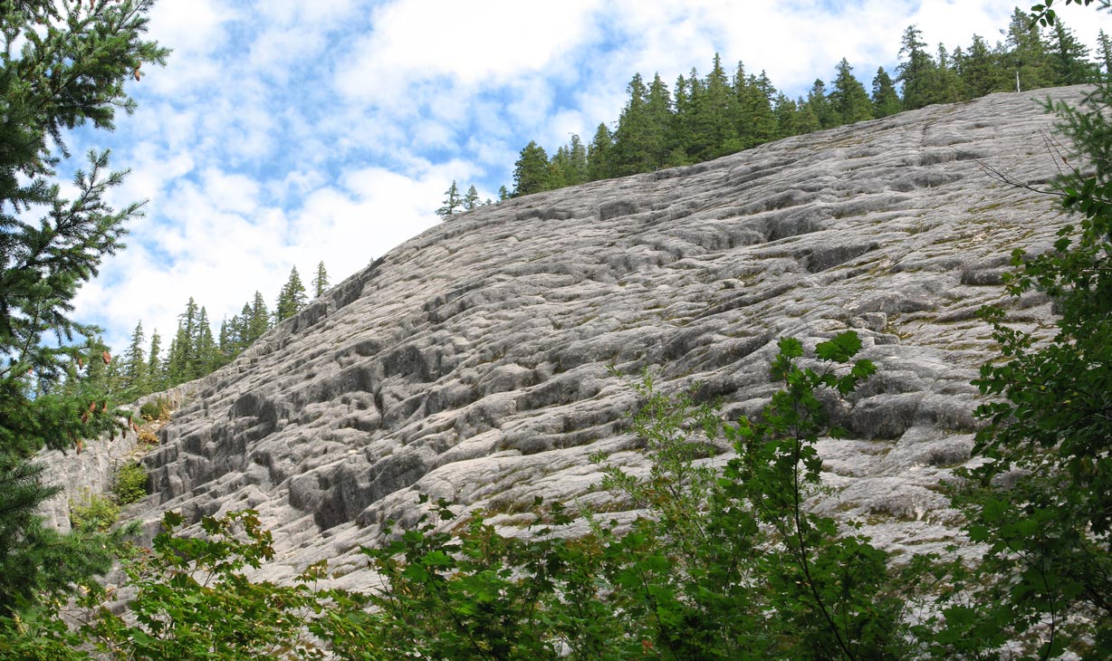
The Monte Cristo Slab (MCS) is a unique diorite slab tucked along the west slope of a minor forested ridge crest overlooking a broad sweeping panorama plateau of the fir tree covered South Prairie region near Trout Lake. The rock slab is a nice example of the kind of granitic slab rock climbing you typically find at places like Leavenworth, Washington, but this crag is just a few hours from Portland. It's an intrusive granitic stock lacking the quartz, thus the slab has a fairly dark tone (and some mineral staining). As the terrain indicates, the site seems to have become visible after the original steep dirt slope abruptly slid downhill (possibly sometime in the last 1,000 years).
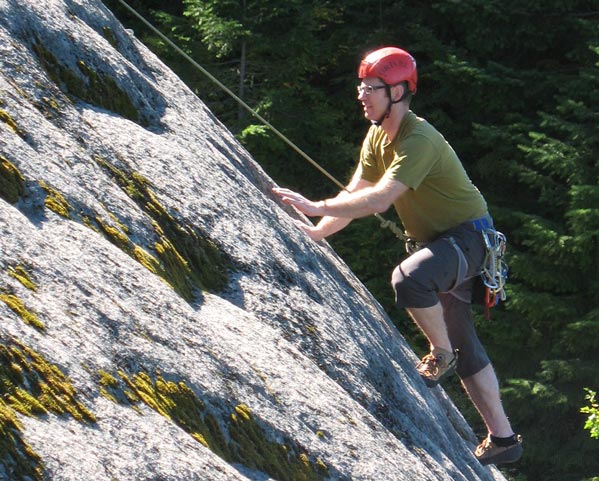
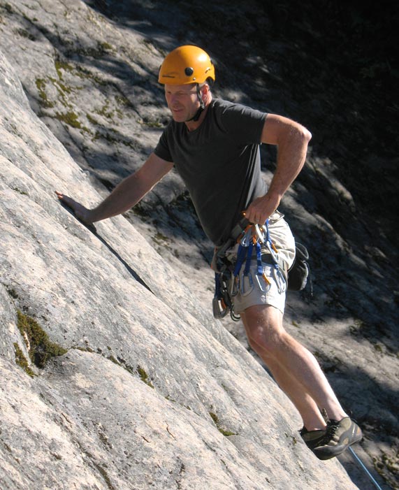
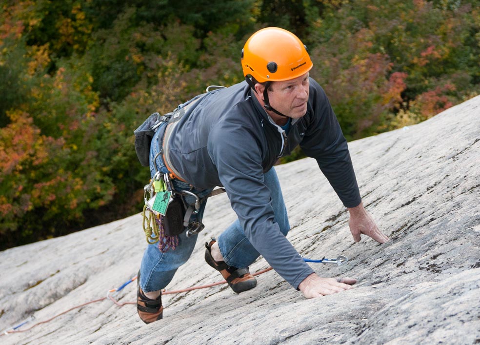
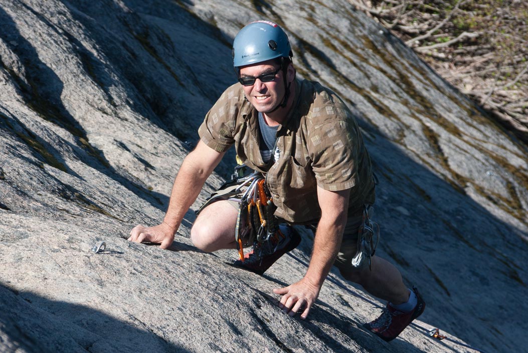
Though not nearly as steep as you typically find at most major granite climbing sites, the MCS none-the-less is a quality destination for locals who relish low angle slab climbing (your fingers will not get a 'pump' factor here).
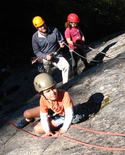
MCS is suitable for young climbers, beginner climbers, old-timer generation climbers, any person who generally enjoys low level climbing ranging from 5.3 to 5.9. The mere fact that the slab is ultra low angle does not lend itself to any extreme ratings, so the 5.11 (and above) type climber will get no adrenalin fix here. The slab is definitely not a suitable hardman climbing crag.
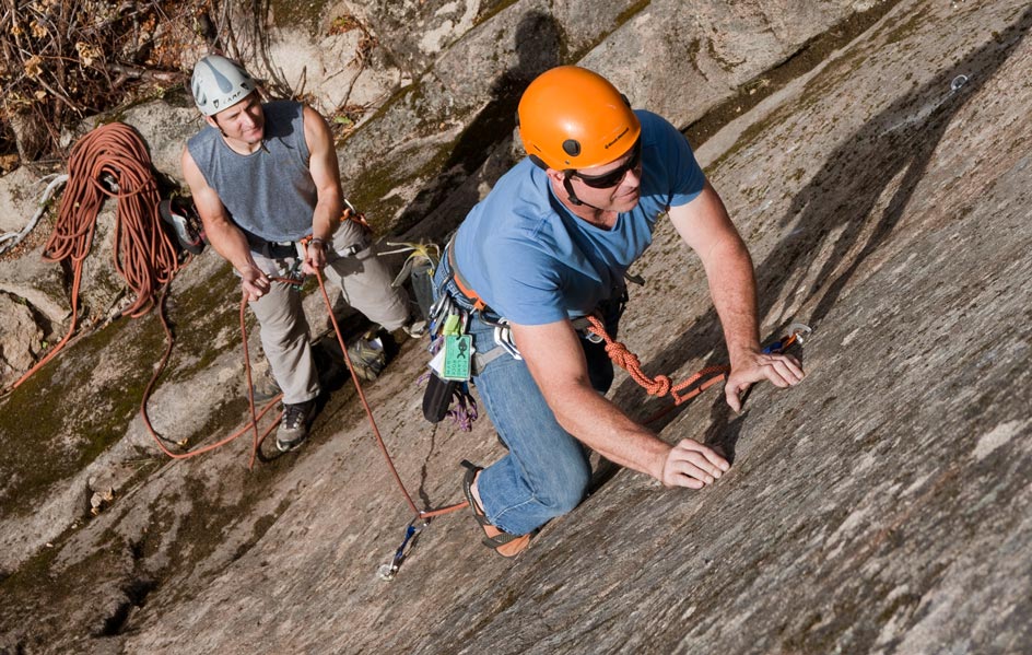
The site is a reasonably nice place for family-style recreational cragging (if you drive an AWD vehicle with high clearance) simply because the ratings tend to be well within that range for kids or young beginner climbers. The youngest person to visit here was age 3 (and that means little Davey was actually top-rope climbing). As with all beginners some precautions are wise, such as not letting the kids wander solo down the steep water runnels, using common sense parental rappel guidance, etc.
Winter months bring plenty of snow at this elevation, and its the sweeping avalanches that provide the slab with some of its unique characteristics. There are distinct sections where the rock slab is scoured smooth, marked by striations, practically featureless, and virtually moss-less, especially at the north end where the slab is the longest and has the lowest angle.
Full detailed beta for MCS is in the Oregon Rock and Boulder guide: ORB at Powell's Books.
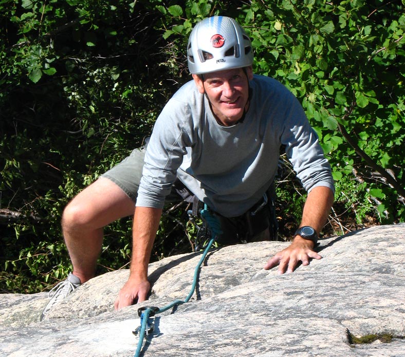
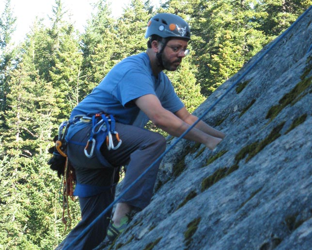
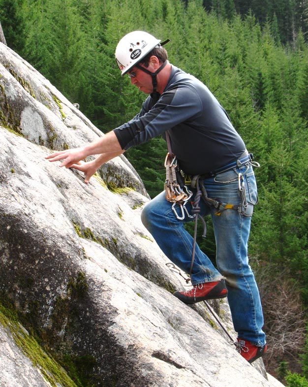
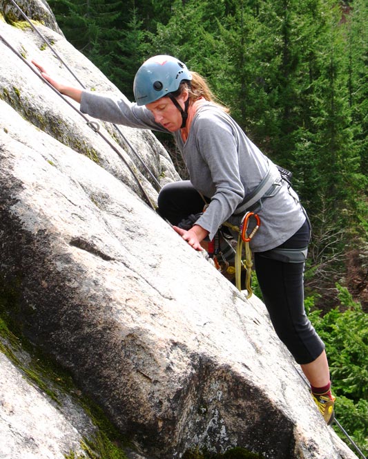
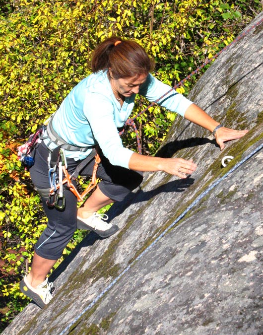
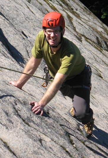
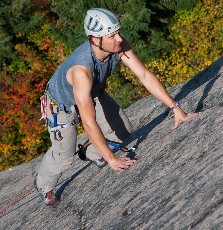
About friction nuances and slab smearing technique. If you are not familiar with friction climbing (most Portland climbers tend to climb on vertical bluffs) then it will likely take you 3-4 visits before some of the technique and rock nuances become familiar to you. Try starting on comfortable level of lead then once you learn a bit of the style and technique progress on to the longer or steeper or stouter leads. Just because it says 5.8 does not mean its the same 5.8 style you climbed at Broughton or Ozone. The slab generally lacks incut holds, though round pockets or dishes, and sloped steps are quite prevalent. To a person who frequently climbs at Squamish or Yosemite this is generally not a learning problem, but for locals who spend their life climbing vertical cliffs (like Ozone) this slab will feel a bit unusual at first. The ratings at MCS are somewhat soft, particularly the easier ratings.
All the routes tend to merge closer at the top (picture the top of a ball or egg) where the routes may be 12' apart at the base but can be 8' apart at the top, where a cluster of routes sit together on miniature dome-shaped aspects (where some routes merge to the same belay). Many of the routes tend to follow some kind of natural nuance in the rock surface which adds to the natural flow of each routes character. That's why its imperative to not 'squeeze job' more climbs between existing climbs.
Just quick-draws, a 70-meter rope (is very ideal if you have one) or a 60-meter rope. No need of any natural rock gear (cams, nuts). Some routes are long enough to warrant the 70-meter rope (some routes are 110' long, very few are about 215' long). Read the book chapter beta for MCS and follow its recommendations.
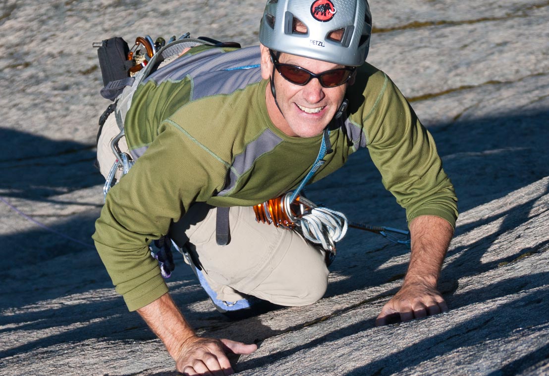
The slab is generally low level climbing ranging from 5.3 to 5.9 mostly, but a few brief steep sections do have some slightly harder ratings. Its not a 5.11, 5.12, nor 5.13 climber's hangout so for those who spend much of their time punching through those ranges, because "its all about the number" then the MCS is not the place for you. Its simply too low angle to provide you the kind of fix you need.
For climber's who are either young or beginners, or of the older generation, the slab has much to offer. Its all here: from the scenery, the basic ratings, the similarity of each climb, the short hike, and more. Technically there are no R/X routes here, but that is all relative based upon your skill level on slab rock. You may not like slab smearing, nor the 9-25' between bolts, but that is the difference between learning skills suitable for vertical rock climbing and slab climbing. If you anticipate sliding here when leading, you may want to wear long pants just in case, though on hot days in July-Aug you may dread the extra stifling layer.
Best to merely walk off down the dark streak water runnel at the south end (if you climb one of the 200' long routes). If you have climbed the short 100' routes its easiest to just rappel that same route. Other viable descents are: walk off to the north and descend via the low angle rock terrain along one of several grooves or slots near the base of the slab.
About ER's. If you get caught in a rain shower while on the slab, its best to stop and lower off from the nearest bolt. If you are able, locate the ER (emergency rappel) with its 90' raps that descend 3 times down into the dark water streak on the south end. Beware of the black lichen (and minor moss) during rainy days or late fall season (October) as it can be very slick. Most of the slab becomes very slick during rainshowers and quite dangerous to walk on. Descending ropeless down the 4th class ravines is not viable. A common central rappel is the 'ravine rappel' near the middle landing zone with its two raps (90' each) that efficiently take you to the base of the crag.
You gotta face reality ̶̶ this place is out in the boonies far from the city lights, so you just might not be into that kind of ultra back woods climbing scene. Some have even said this is sasquatch country.
DRIVING DIRECTIONS:
Option #1 - Using SR141 (the best approach option):
Its best to access this site via the much better maintained roads starting at White Salmon, Washington. From WA State Route 14, drive north on SR141a (or SR141) for about 25 miles till you reach the tiny community of Trout Lake. At the 'Y' on the main SR141, go left through town on SR141 as it trends west for about 4 miles. Turn south onto gravel road NF86 road and drive south for 1.8 mile. This same mainline gravel road becomes NF8620 road. Drive this road west for 1 mile. At a road fork 'Y' drive west on Cave Creek Road (NF8631) for 3.9 miles. At the head of the valley this road quickly gains elevation till it reaches the pass and junctions at a road 'T' where it junctions with NF070 road. Go left (south) on NF070 road for a short distance of 1/2 mile. Turn right (SW) onto NF6610 road and drive for 1/2 mile. Turn left onto a narrow gravel road NF6610-030 and drive a very short distance (1/10 mile or 615'), then turn east (left) onto a very narrow gravel road NF717 and drive for .2 mile till you reach the parking area loop.
Option #2 - Carson Guler Road NF86:
Going west out of Trout Lake on paved NF86 road. Drive about 1 mile past the Guler Ice Cave on NF86 paved road. Turn south and drive south on gravel road NF041 till you reach a junction. Then drive NF8620 west to a road fork 'Y', then south a short distance on NF8620070, then drive south on NF070, then SW on NF6610 (1/2 mile), then turn left and drive on NF6610-030 (1/10 mile), then finally left onto NF717 to the parking loop area.
Option #3 - Using both NF66 and NF86 Carson Guler Road:
Drive NF66 till you reach South Prairie Pond, and continue on NF66 north for another 3.3 miles till you reach the paved road NF86. Drive EASTWARD on paved NF86 for 2.8 miles till you reach NF041 gravel road. Drive south on gravel road NF041. Then drive NF8620 west to a road 'Y' fork, then south a short distance on NF8620070, then south on NF070, then SW on NF6610 for 1/2 mile, then turn left and drive on NF6610-030 for 1/10 mile, then finally left onto NF717 to the parking loop area.
Option #4 - Using the high clearance AWD option on NF6610:
Note: the western portion of NF6610 gravel road (from NF66 onto NF6610) is rapidly becoming unsuitable for driving on (except with very high clearance vehicles). In 15+ years that segment may become difficult even for that kind of vehicle. This approach is described below for those who like adventure driving.
From Portland, Oregon go east on I-84 freeway, cross at Cascade Locks on Bridge of the Gods bridge. Go east on State Route 14 (past Dog Mtn trailhead). Turn north on Cook-Underwood Road (CR86) Drive 5.1 miles. Turn left (north) on Willard Road. Drive 2.1 miles (passing through Willard). Willard Road becomes Oklahoma Road at Willard. Just beyond Willard turn left onto NF66 road (South Prairie Rd). Drive north on paved road NF66 for 12.7 miles (becomes gravel). Drive east on gravel road NF6610 for 2.2 miles (this section of road presently requires AWD vehicle clearance). Turn right on NF6610-030 and drive 1/10 mile. Turn left on a narrow old logging grade for 2/10 mile. Park at a circular loop turnaround sizable enough to hold perhaps 7-9 cars. Driving time from east Portland is about 2 hours (about 1¾ hours if your really fast), or from Hood River its a quick 50-minute drive.
PATH - From the parking area:
Hike the north path, or the main path (both start at the parking spot but split in the first 50'). A path follows along the entire base of the slab so hiking up either trail works well for all cragging needs.Note: some of the gravel roads in this part of Skamania county are not well maintained, so anticipate the worst (use a USFS map) just in case you need to drive in via another gravel road. Road washouts do occur due to rain or winter conditions and the time frame to get some of it repaired may be years.
Leave your power drill at home; all the hard work is done, and all the routes are fully developed by 'The Group'. Read the stewardship goals on the site. Do not strive to 'squeeze job' more climbs between existing climbs. The present routes are identifiable as lead routes because of the distinct separation.
The stewardship framework for this site encompasses generally similar parameters common to other crags. Some of the MCS rock climbing Stewardship Advisory Group processes include: path access maintenance factors, parking area maintenance factors, coordinated group outings such as site project efforts, anchor program, inter-relations liaison with various regional entities and agencies, and various recreational site specific concepts with long-term strategic awareness and etiquette continuity ideals.
The basics for climbers and parking options:
- There is limited parking space so carpool. Do not block the turn-around loop.
- Avoid car camping at the parking site. Camp along nearby gravel roads, or use local campgrounds.
- Avoid making campfires at the parking area. It's a substantial fire risk with no nearby emergency water to put it out.
- Consider limiting your total personal team or party size to 1-20 persons maximum.
- All commercial fee-based guiding in this Forest Service district is permit regulated. Various technical points about the MC slab:
- Descend from the cliff top by using designated methods: use the 4th class water-streak descent at the South End (or at the North End of the cliff); or descend using the established 100' rappel routes. Beware of climber's below you.
- Preferably only ground-up lead the popular and steep (200'+) headwall rock climbs. Avoid rappelling down those routes (e.g. rope snag and rope drag).
- Several minor sections at the top of the cliff (near the trees) have some loose debris. Avoid dragging a rope across those sections. Tread with caution in those areas. Some basic extraneous points:
- Your toilet needs. Find a private pooh spot deep in the forest away from the base of the crag and away from the approach paths.
- Consider leaving your pet at home, but if you bring it here keep it controlled (e.g. leashed).
- The site has about 4-5 common base areas where folks tend to gather to meet and prepare to climb. The square foot space of each of these areas is narrow so use common courtesy practices.
- Do not leave non-degradable trash.
- Leave the power drill at home. All the work is done.
The views from the top of the slab are one of the qualities of climbing here. You can see distant Lemei Rock in Indian Heaven, the South Prairie Pond, the Big Lava Bed, Huckleberry Mtn., and much more.
DegMinSec, NAD83, Latitude 45° 55' 24" N, Longitude -121° 39' 48"W
Lowest point (2nd lobe): 3,518'
Highest point (upper left): 3,818'
Width (top to bottom): 500' horizontal
Length (south to north): about 820'
Vertical height in feet elevation: 300'
Enjoy climbing at MCS.